
For off-road adventures, you need reliable navigation tech like GPS devices with enhanced antennas, multi-satellite system compatibility, and offline maps to stay connected in remote areas. Trail mapping apps with real-time terrain details help you plan routes and avoid obstacles. Combining these tools guarantees you won’t get lost, even in dense forests or rocky landscapes. Keep exploring to discover how these features come together for the ultimate off-road navigation experience.
Key Takeaways
- Use rugged GPS devices with multi-satellite system support (GLONASS, Galileo, BeiDou) for improved accuracy in remote areas.
- Opt for offline digital trail maps with topographical details to navigate without cellular coverage.
- Prioritize devices with enhanced antenna technology to mitigate signal interference from terrain features.
- Incorporate real-time terrain and trail condition updates to adjust routes proactively.
- Utilize features like waypoint marking and route planning to stay confident and safe off the beaten path.
Exploring off-road terrains offers thrilling adventures, but traversing these challenging environments requires reliable technology. When you’re venturing into remote areas, traditional maps or smartphone signals might not cut it. That’s where advanced navigation tech comes into play, especially tools focused on trail mapping and GPS accuracy. These technologies are your best allies in guaranteeing you stay on course, avoid getting lost, and explore with confidence.
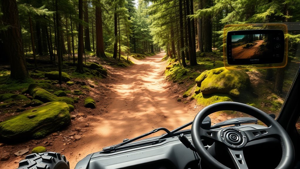
Trail mapping is a game-changer for off-road enthusiasts. Instead of relying solely on physical maps, you can use digital trail maps that provide detailed routes through rugged terrain. These maps often include topographical features, trail conditions, and points of interest, all of which help you plan your route more effectively. With trail mapping apps or devices, you can visualize your surroundings in real-time, making it easier to choose the best paths or reroute if you encounter obstacles. This precision is especially crucial when you’re navigating through dense forests, rocky paths, or unfamiliar wilderness, where traditional maps can be cumbersome or outdated.
Digital trail maps enhance off-road navigation with detailed, real-time route planning and terrain insights.
GPS accuracy is equally critical. Off-road environments pose unique challenges to GPS signals—trees, mountains, and terrain can interfere with satellite reception, leading to inaccuracies. That’s why investing in a GPS device designed for off-road adventures is essential. These devices often feature enhanced antennas and multiple satellite system compatibility (like GLONASS, Galileo, and BeiDou), boosting their ability to lock onto signals even in tough conditions. Accurate GPS data ensures you know your exact location, track your progress, and maintain awareness of your surroundings. It also helps in emergency situations, allowing rescue teams to pinpoint your position swiftly if needed.
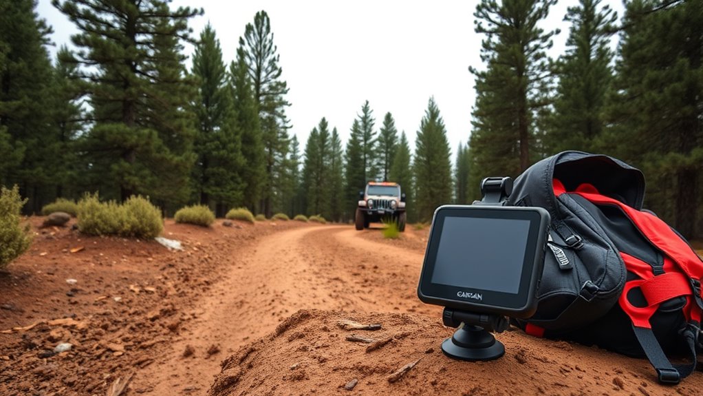
Modern off-road navigation tech often combines trail mapping with high-precision GPS, giving you a thorough picture of your journey. Some devices integrate topographic data, waypoint marking, and even offline map storage, so you’re not dependent on cellular signals. This means you can confidently explore remote trails, knowing your tech will keep you oriented no matter where you venture.
Ultimately, reliable trail mapping and GPS accuracy are your best tools for off-road navigation. They transform potential chaos into a manageable adventure, helping you stay on track and discover new routes safely. Whether you’re tackling rugged mountain trails, forest paths, or desert landscapes, using advanced navigation tech ensures your off-road experience is not only exhilarating but also safe and well-guided. As you prepare for your next adventure, invest in the right tools, and let technology lead the way through the wilderness.

Lightning GPS GL300 Car Tracker Device for Vehicles w/Magnetic Case – Hidden GPS Tracker for Fleet Security, Long Range Vehicle Tracking, Discreet, Ideal for Cars and Trailers, Subscription Required
- Discreet Vehicle Tracking: Compact design with magnetic case
- Long-Range GPS Monitoring: Real-time updates over extended distances
- Easy, Portable Installation: Magnetic attachment for quick setup
As an affiliate, we earn on qualifying purchases.
As an affiliate, we earn on qualifying purchases.
Frequently Asked Questions
How Do I Update My Off-Road Navigation Devices?
To update your off-road navigation device, start by connecting it to Wi-Fi or your computer. Check the manufacturer’s website or app for the latest map updates and firmware upgrades. Download and install these updates, ensuring your device has enough storage space. Follow the on-screen instructions carefully, and restart your device afterward to complete the process. Regular updates keep your navigation accurate and reliable on your off-road adventures.
What’s the Battery Life of Off-Road GPS Units?
Off-road GPS units typically offer a battery longevity of 8 to 20 hours, depending on the device and usage. You can extend this time with good power management practices, like turning off unnecessary features and reducing screen brightness. Some units also have replaceable or rechargeable batteries, so you can carry spares or recharge during breaks. Be sure to check your device’s specifications for the most accurate battery life expectations.
Are There Any Apps for Offline Navigation?
Yes, there are several apps for offline navigation, perfect for off-road adventures. You can download offline maps and use GPS caching features to guarantee you stay on track even without cell service. Apps like Gaia GPS, Maps.me, and Avenza Maps let you save maps beforehand, so you can navigate confidently in remote areas. Just make sure to preload your offline maps and enable GPS caching for the best experience.
How Do I Calibrate a Compass for Off-Road Use?
Don’t let your compass go haywire; calibrating it correctly guarantees you stay on the right track. To do this, find a level surface and hold the compass flat. Rotate it slowly in a circle to calibrate, then adjust for magnetic declination based on your location for precise readings. This simple step ensures your compass points true, helping you navigate accurately even when you’re off the beaten path.
Can Navigation Tech Work Without Cell Service?
Yes, navigation tech can work without cell service. Devices like GPS units use satellite imagery and preloaded topographic maps to guide you even in remote areas. Make sure to download these maps beforehand, so you’re not dependent on internet connectivity. With a reliable GPS device, you can confidently navigate off-road trails, ensuring you stay on track and reach your destination safely, no matter how far from cell towers you are.

onX Offroad App – Nationwide Digital Trail Map Membership for Phone, Tablet & Computer – 375K+ Miles of Off-Road Trails, Open/Closed Status, Google Imagery & Offline Maps for All 50 States
- Extensive Trail Database: Over 375,000 miles of trails nationwide
- Real-Time Trail Status: Open or closed trail updates included
- High-Resolution Satellite Imagery: Google Earth imagery for terrain scouting
As an affiliate, we earn on qualifying purchases.
As an affiliate, we earn on qualifying purchases.
Conclusion
As you navigate rugged trails and untamed landscapes, let the right tech be your guiding star. Feel the thrill of discovery as GPS devices and rugged maps light your way through shadowed forests and rocky passes. Embrace the adventure, trusting your gear to keep you on course. With each turn and twist, you’ll forge unforgettable memories, all while your trusted navigation tools lead you safely back home. Off-road adventures become stories you’ll cherish forever.

Garmin 010-02256-00 eTrex 22x, Rugged Handheld GPS Navigator, Black/Navy
- Reliable Handheld GPS: Explore confidently with this device
- Sunlight-Readable Display: 2.2-inch color screen with high visibility
- Preloaded Topo Maps: Includes routable roads and trails for outdoor activities
As an affiliate, we earn on qualifying purchases.
As an affiliate, we earn on qualifying purchases.

Garmin Montana 700, Rugged GPS Handheld, Routable Mapping for Roads and Trails, Glove-Friendly 5" Color Touchscreen
- Durable MIL-STD 810 Construction: Resistant to thermal, shock, water, vibration
- Glove-Friendly 5-inch Touchscreen: Larger display with versatile mounting options
- Multi-GNSS Support: GPS, GLONASS, Galileo with preloaded maps
As an affiliate, we earn on qualifying purchases.
As an affiliate, we earn on qualifying purchases.